Installation
# install.packages("devtools")
devtools::install_github("energyRt/globalwindatlas")
Setup
# install.packages("geodata")
library(globalwindatlas)
library(terra)
#> terra 1.7.39
library(sf)
#> Linking to GEOS 3.11.2, GDAL 3.6.2, PROJ 9.2.0; sf_use_s2() is TRUE
library(ggplot2)

## set directory to store downloaded files
gwa_set_dir("data/gwa")
Download annual averages
## download wind capacity factors
# gwa_get_wind_cf("BGD", IEC = 1) # wind-class #1
gwa_get_wind_cf("BGD", IEC = 2) # wind-class #2
#> [1] "data/gwa/BGD_capacity_factor_IEC2.tif"
# gwa_get_wind_cf("BGD", IEC = 3) # wind-class #3

## download wind speed data
gwa_get_wind_speed("BGD", height = 100)
#> [1] "data/gwa/BGD_wind_speed_100.tif"
# gwa_get_wind_speed("BGD", height = 150)
# gwa_get_wind_speed("BGD", height = 200)

# select data to plot
obj <- gwa_get_wind_cf("BGD", IEC = 2)

## plot
tr <- rast(obj)
plot(tr, main = "Wind capacity factors")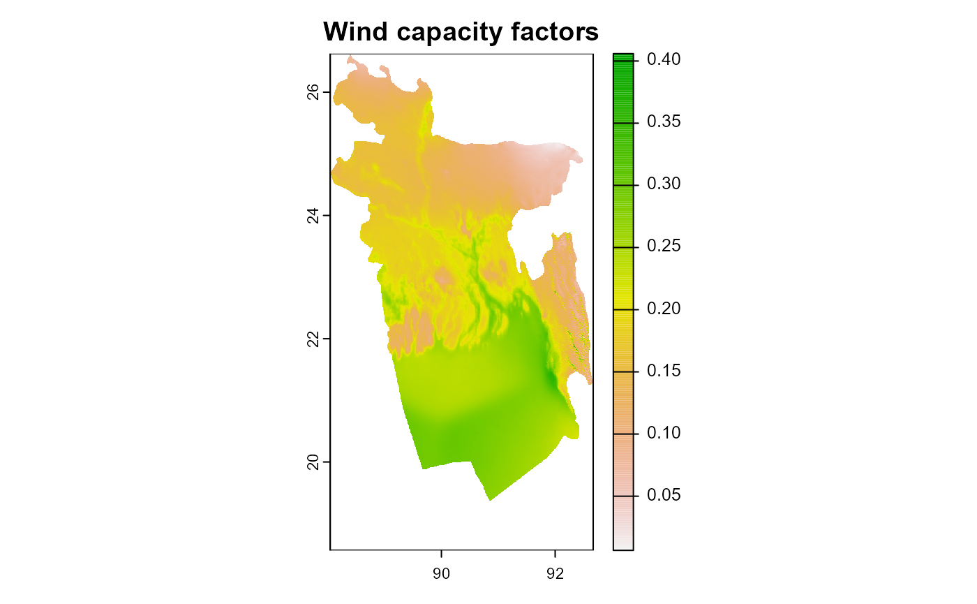
summary(tr)
#> Warning: [summary] used a sample
#> BGD_capacity_factor_IEC2
#> Min. :0.01
#> 1st Qu.:0.15
#> Median :0.19
#> Mean :0.20
#> 3rd Qu.:0.25
#> Max. :0.41
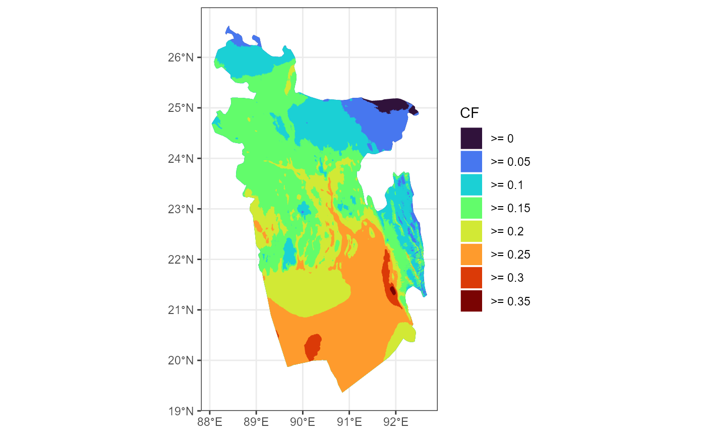
#> NA's :49764Group locations by intervals of capacity factor
ggplot(gwa_iec2_sf) +
  geom_sf(aes(fill = eq), color = NA) +
  scale_fill_viridis_d(option = "H", direction = 1, name = "CF") +
  theme_bw()